Lotbinière (municipalité régionale de comté)
| Lotbinière.mw-parser-output .entete.map{background-image:url("//upload.wikimedia.org/wikipedia/commons/7/7a/Picto_infobox_map.png")} | ||||
 | ||||
| Administration | ||||
|---|---|---|---|---|
Pays | ||||
Province | ||||
Région | Chaudière-Appalaches | |||
Statut municipal | Municipalité régionale de comté | |||
Chef-lieu | Sainte-Croix | |||
Préfet | Maurice Sénécal 2013-2017 | |||
Constitution | 1er janvier 1982 | |||
| Démographie | ||||
Population | 31 741 hab. (2016) | |||
| Densité | 19 hab./km2 | |||
| Géographie | ||||
Coordonnées | 46° 31′ 00″ nord, 71° 36′ 00″ ouest | |||
Superficie | 166 350 ha = 1 663,50 km2 | |||
| Divers | ||||
Langue(s) parlée(s) | Français | |||
Fuseau horaire | UTC−05:00 | |||
Indicatif | +1 418, +1 581 | |||
Code géographique | 330 | |||
| Localisation | ||||
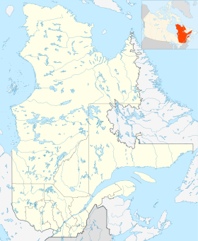
| Géolocalisation sur la carte : Québec
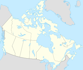
Géolocalisation sur la carte : Canada
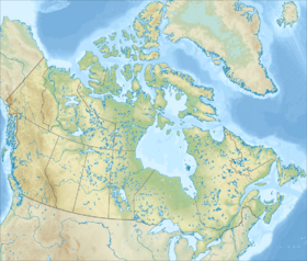
Géolocalisation sur la carte : Canada
| ||||
| Liens | ||||
Site web | www.mrclotbiniere.org | |||
modifier | ||||
Lotbinière est une municipalité régionale de comté (MRC) du Québec (Canada), situé dans la région de Chaudière-Appalaches. Son chef-lieu est Sainte-Croix. Les habitants sont les Lotbiniérois, à la différence des habitants de Lotbinière, les Lotbiniériens[1].
Sommaire
1 Géographie
2 Municipalités de la MRC de Lotbinière
3 Éducation
4 MRC et territoires équivalents limitrophes
5 Lien externe
6 Références
Géographie |
Dans la région : Chaudière-Appalaches.
Cette section est vide, insuffisamment détaillée ou incomplète. Votre aide est la bienvenue ! Comment faire ?
Municipalités de la MRC de Lotbinière |
| Nom | Type | Population (2016)[2] | Superficie (km2) | Densité (hab./km2) |
|---|---|---|---|---|
Municipalités locales | ||||
Dosquet | Municipalité | 944 | 65,09 | 14,5 |
Laurier-Station | Municipalité de village | 2 573 | 12,16 | 211,6 |
Leclercville | Municipalité | 473 | 136,50 | 3,5 |
Lotbinière | Municipalité | 814 | 79,94 | 10,2 |
Notre-Dame-du-Sacré-Cœur-d'Issoudun | Municipalité de paroisse | 861 | 60,33 | 14,3 |
Saint-Agapit | Municipalité | 4 280 | 64,44 | 65,4 |
Saint-Antoine-de-Tilly | Municipalité | 1 598 | 60,20 | 26,5 |
Saint-Apollinaire | Municipalité | 6 110 | 96,95 | 63,0 |
Sainte-Agathe-de-Lotbinière | Municipalité | 1 168 | 166,99 | 7,0 |
Sainte-Croix | Municipalité | 2 516 | 69,86 | 36,0 |
Saint-Édouard-de-Lotbinière | Municipalité de paroisse | 1 194 | 98,43 | 12,1 |
Saint-Flavien | Municipalité | 1 618 | 66,24 | 24,4 |
Saint-Gilles | Municipalité | 2 525 | 177,43 | 14,2 |
Saint-Janvier-de-Joly | Municipalité | 984 | 109,73 | 9,0 |
Saint-Narcisse-de-Beaurivage | Municipalité de paroisse | 1 106 | 61,93 | 17,9 |
Saint-Patrice-de-Beaurivage | Municipalité | 1 036 | 85,55 | 12,1 |
Saint-Sylvestre | Municipalité | 1 019 | 147,18 | 6,9 |
Val-Alain | Municipalité | 924 | 102,32 | 9,0 |
Total | 31 741 | 1 662,27 | 19,1 | |
Éducation |
- Commission scolaire des Navigateurs
- Commission scolaire des Bois-Francs
MRC et territoires équivalents limitrophes |
- Portneuf
- Lévis
- La Nouvelle-Beauce
- Robert-Cliche
- Les Appalaches
- L'Érable
- Bécancour
Lien externe |
- Site officiel de la MRC de Lotbinière
Références |
Commission de toponymie du Gouvernement du Québec
Source: Recensement canadien de 2016
 Portail de la Chaudière-Appalaches


